Ascent across alpine pasture
After a quick „deep breath” and a photo we cross the minor alp on a narrow meadow climb and our altimeter showes 1,950 m.
Again there is a short passage through the forest and we can already now notice that one thing will remain unchanged: it continuosly goes uphill. Stretches that might perhaps be flat for some part and therefore provide a bit of “relaxation” are missing.
We meet the first two hikers, i.e. they are overtaking us on their way up. By now it is 10.05 hours and the forest is turning again into more open space. The altimeter shows 2,050 m.
Jolly cow-bell ringing is accompanying us on the way up over sunny meadow slopes. We quit this idyllic sound effects, step over a pasture fence resp. a ribbon, and soon afterwards we leave the last trees at the height of approx. 2,250 m behind us. Looking back we can again see the well known panorama with Latsch, the Martell Valley and the Hasenöhrl, Zufritt- and the Laaserspitze.


- Left: At the start of our hiking trip, alpine pasture somewhat flatter.
- Centre: Increasingly the path gets steeper and the vegetation sparcer.
- Right: Above the tree line it continues steeply uphill and the terrain gets rockier.
Above the timber line it gets rockier
At 11.00 o’clock we realise how slowly we are rambling uphill, because a single climber comes joggingly downhill. At a watering place, that is being used by goats, he tells us that he come up with the first train at 7.00 o’clock from St. Martin, reached the summit within 2 hours (!) and now has to hurry down (presumably in half the time!), because he has to go to work this afternoon.
Then he continues his „flying descent“ and we are united that this is not our measure! We still have to manage 600 metres in altitude and now we proceed on a steep and rocky slope of meadows.

A somewhat steeper passage to 2,500 m needs step-guarantee.
At 11.15 hours we meet four more climbers at their descent and we get the feeling to be the last ones at our ascent. 2,400 m have now been reached and it gets rockier. 30 minutes later we pass the 2,.600 m mark and a new sentiment comes up: the summit gets closer! It now means we have to cross a field of rock-debris – it looks a bit as if giants had thrown boulders.
12.15 hours: The altimeter is being read again: 2,800 m. The terrain is very steep and loose gravel slippes away with one or the other footstep. We have to take a deep breath again and rest for 5 minutes, this time on a big stone which lookes like a bench. A sip of water and then up to the end spurt. The huge cross on the summit is already within reach.
Beautiful view and peace at the summit
12.30 hours: On Top! The Vermoispitze is concered. We congratulate ourselves on the successful mountain adventure. The two hikers who overtook us at the beginning, are on their way down, so the summit now belongs to us alone.
Silently we are enjoying the 360° panorama, which got even hazier in the meantime, distinctly emphasising the Similaun. The tranquility is pleasant and infatuating. Speechless we are enjoying this moment for a while, everyone in his own thoughts.


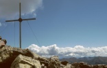
- Left:Summit cross on the Vermoispitze: from here one gets a beautiful all-round view to the main crest of the Ötztaler Alps and to the Vinschgau as well as to the Ortler Alps.
- Centre: View from the Vermoispitze northbound to the Similaun.
- Right: View from the Vermoispitze southbound to the Ortler Alps (left the Hasenöhrl to be seen with 3,256 m).
Then we get moving again: take pictures, share “Vinschgers” (typical South Tyrolean type of bread) and biscuits, drink water, sign the summit book. 50 minutes for our summit rest is quite a long time, but the stable weather in September does permit it. The breeze has dried our shirts and at 13.20 hours we are ready for our descent.
And now we are being superseded at the summit, because two more climbers – a young couple – are coming up. So we are not the last ones up here. Just as well!

